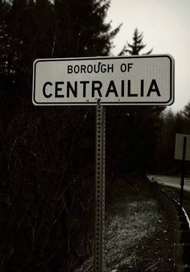
Centralia
Centralia is a near-total ghost town and borough in Columbia County, Pennsylvania, United States, situated at the core of the state's historic Anthracite Coal Region. Established in the mid-19th century atop rich deposits of high-grade anthracite coal, Centralia became the site of an uncontrollable subterranean mine fire in May 1962. Smoldering through interconnected underground shafts across hundreds of acres, the fire caused extensive surface fissures, toxic gas venting, and the federal condemnation and buyout of the municipality, transforming Centralia into America's most iconic modern ghost town and the direct real-world inspiration for the film adaptation of Silent Hill.
The legend
Danger Level: Orange (Documented geological collapse hazards into superheated subterranean voids and lethal carbon monoxide seepage) Across popular lore and regional mythmaking, Centralia evolved into an archetype of a "hell on Earth." The foundational folklore stems from the Curse of Father Daniel Ignatius McDermott. In 1869, the Roman Catholic priest was assaulted by militant members of the Molly Maguires, an Irish clandestine labor organization; according to regional legend, McDermott cursed the town, prophesying that Centralia would one day be consumed by fire and wiped off the map, leaving only the church on the hill standing. Following Christophe Gans's 2006 film Silent Hill (which utilized Centralia's smoldering terrain and cracked asphalt as its core aesthetic reference), urban mythology exploded: visitors attributed occult dimensions to the site, claiming perpetual ash fell from the overcast sky and demonic groans echoed through steaming fissures. Another pervasive conspiracy theory alleged that the evacuation was an engineered government plot to seize billions of dollars in privately held anthracite reserves.
What actually happened?
The demise of Centralia is a fully documented environmental disaster detailed in investigations such as David DeKok's Fire Underground:Ignition source: In May 1962, the Centralia Borough Council hired volunteer firefighters to clear an unregulated municipal landfill situated inside an abandoned strip-mine excavation near the Odd Fellows Cemetery prior to Memorial Day. The trash was incinerated and doused. However, an unsealed opening in the quarry floor concealed an unmapped conduit descending directly into the underlying labyrinth of the Buck Mountain anthracite coal seam. The embers ignited the coal strata.Anthracite combustion dynamics: Anthracite is the densest metamorphic coal, containing 90–95% fixed carbon. While difficult to ignite, once hot it burns persistently at temperatures exceeding 500–700 °C. The vast network of abandoned regional mine galleries acted as subterranean flues, providing continuous convective airflow that sustained the fire.Bureaucratic failure: Throughout the 1960s and 1970s, municipal, state, and federal agencies staged piecemeal attempts to contain the fire via water pumping, fly-ash slurry barriers, and trench isolation. Administrative indecision, cost overruns, and incomplete mining blueprints allowed the combustion front to bypass subterranean containment barriers.Imminent danger to the population: By the late 1970s, conditions turned catastrophic. In 1979, gas station proprietor and mayor John Coddington recorded fuel temperatures inside his underground storage tanks reaching 77.8 °C (172 °F). On February 14, 1981, twelve-year-old Todd Domboski plummeted into a sudden 45-meter-deep subsidence fissure that collapsed beneath his feet in his grandmother's backyard, venting steam with fatal carbon monoxide levels; the boy was pulled out by his cousin. Household basements accumulated toxic concentrations of carbon monoxide ($CO$) and carbon dioxide ($CO_2$), inducing chronic nausea and hypoxia among residents.Relocation and eminent domain: In 1983, the US Congress authorized a $42 million relocation buyout program, moving over 1,000 residents to nearby Mount Carmel and Ashland. In 1992, Pennsylvania Governor Robert P. Casey declared eminent domain over all remaining municipal parcels. The US Postal Service revoked the 17927 ZIP code in 2002. In 2013, a state court settlement allowed the remaining holdout residents to reside in their houses for the remainder of their natural lives, after which the titles transfer to the Commonwealth of Pennsylvania for demolition. The underground fire spans over 400 acres and is projected to burn for another 100 to 250 years.
History
The land was acquired from the Iroquois Confederacy in 1749. In 1856, mining engineer Alexander W. Rea planned the village, originally named Centreville and renamed Centralia in 1865 upon incorporation. In 1868, Rea was murdered by members of the Molly Maguires labor resistance. By 1890, the population peaked at roughly 2,700 residents supported by five major collieries, housing schools, banks, and churches. Following the Great Depression, commercial mining collapsed, leaving operations to informal bootleg miners. Following the 1962 fire and twenty years of containment failures, over 500 structures were systematically bulldozed between 1984 and the late 1990s. The 1.2-kilometer bypassed section of Route 61 ("Graffiti Highway"), abandoned in 1993 due to severe thermal buckling, evolved into a counter-culture tourism landmark; in April 2020, private land investment group Fox Coal buried the entire roadway under tons of dirt and rock piles to deter crowds during the COVID-19 pandemic.
Where is it?
Columbia County, Pennsylvania, United States; situated between Ashland and Mount Carmel along the junction of Pennsylvania Routes 61 and 42 (roughly 180 kilometers northwest of Philadelphia and 200 kilometers west of New York City).
Can you visit?
Yes, the remaining street grid (Locust Street, Center Street) remains public municipal roadway accessible via automobile or on foot. The rerouted mainline of PA Route 61 cuts directly through the borough footprint. The sole surviving institutional building within borough lines is the active Assumption of the Blessed Virgin Mary Ukrainian Greek Catholic Church, perched securely on a northern stone ridge outside the fire zone. The famous "Graffiti Highway" sits entirely on private land, remains buried beneath earth mounds, and is actively patrolled by the Pennsylvania State Police, with trespassing citations issued to violators. Visitors must observe strict field precautions: venturing off paved roads onto unmonitored brush clearings is dangerous due to unmapped subsurface collapses; approaching smoking fissures or thermal boreholes carries fatal risks of odorless, colorless carbon monoxide inhalation.
Oradour-sur-Glane
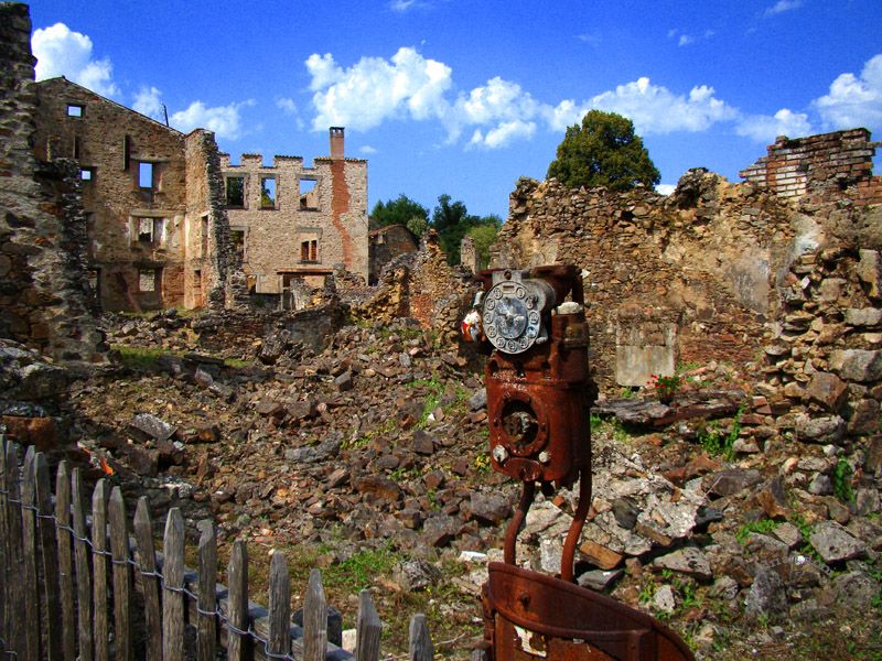
Oradour-sur-Glane is a preserved ghost village and national memorial located in the Haute-Vienne department of Nouvelle-Aquitaine, France, situated along the Glane River roughly 22 kilometers northwest of Limoges. On June 10, 1944, the tranquil rural community was systematically liquidated by the 2nd SS Panzer Division Das Reich, who massacred 643 civilians (including 247 women and 205 children) before putting every structure to the torch. Following the liberation, French Provisional Government President Charles de Gaulle decreed that the skeletal ruins remain entirely untouched as an open-air national shrine and enduring monument to Nazi wartime atrocities against civilian populations.
Comments
No comments yet. Be the first.