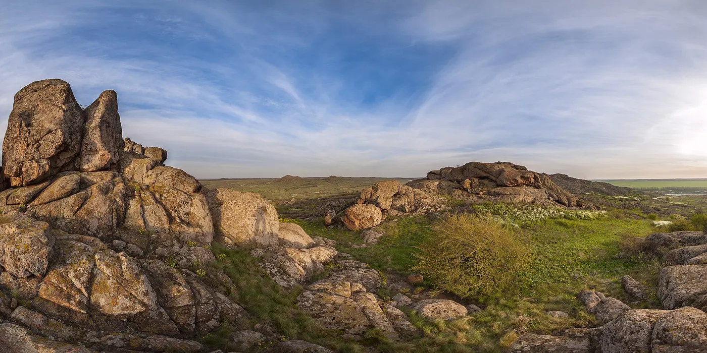
The Stone Graves
The Kamiani Mohyly ("Stone Tombs") Nature Reserve is a compact granitic inselberg formation spanning approximately 400 hectares, rising dramatically above the open Priazovian steppe along the Karatysh River (at the border of Donetsk and Zaporizhzhia Oblasts). For over a century, local historians, geographers, and travelers linked this 100-meter-tall labyrinth of pink granite crags to the chronicle-attested Kalka River and the tragic Battle of 1223—the first catastrophic clash between combined Kievan Rus'-Cuman forces and the Mongol reconnaissance vanguard led by Jebe and Subutai.
The legend
Danger Level: Yellow (Historical battlefield site wrapped in tragedy and dark lore, with no physical paranormal threat) According to enduring regional lore, it was precisely within this natural granite fortress that Grand Prince Mstislav Romanovich of Kiev established his fortified wagon fort (tabor) and withstood a three-day siege after the rout of the main Russian-Cuman cavalry. Tradition states that following the false truce pledged by the allied Brodniki chieftain Ploskyna promising "no royal blood shall be shed," the princes surrendered: the Mongol commanders laid them beneath heavy wooden dining platforms and celebrated their triumph atop the dying rulers, crushing them to death directly against the bedrock. Local folklore claims the scarlet lichens and reddish oxidation on the granite cliffs are indelible stains of spilled royal blood, and that the crags hide mass tumuli, phantom sentinels, and the lost campaign treasury of the Kiev princes.
What actually happened?
The direct association between the Kamiani Mohyly cliffs and the primary battlefield of the Kalka is largely an artifact of late-19th- and 20th-century historiographical conjecture (popularized by Soviet geographer K. V. Kudryashov). In regional steppe vernacular, the word "mohyla" (tomb/grave) traditionally denoted any prominent natural hill or rocky prominence, not necessarily an engineered burial barrow. The outcrops are natural Proterozoic granite intrusions roughly 1.8 to 2 billion years old, exposed via millions of years of differential erosion of the surrounding soft soils. Rigorous archaeological surveys by the Institute of Archaeology of the National Academy of Sciences of Ukraine failed to identify the expected physical footprint of a major 1223 engagement: no mass military burials, equine skeletal remains, iron arrowheads, or fragments of medieval weaponry were recovered within the reserve. Leading modern historians conclude that the chronicle-recorded Kalka River corresponds to the modern Kalchik (a tributary of the Kalmius near Mariupol) or the Berda River, and the actual encirclement and destruction of Mstislav's wagon fort occurred across open alluvial steppe plains miles away from these granite outcrops.
History
The Battle of the Kalka River occurred on May 31, 1223, ending in a catastrophic defeat for the Rus' principalities, who critically underestimated the coordinated mobility and feigned retreat tactics of Subutai and Jebe. Long before medieval warfare, the geological formation functioned as a ritual sanctuary during the Bronze Age, preserving Kurgan culture burials and ancient rock carvings. In April 1927, Soviet Ukrainian authorities designated the area a state nature reserve (later an autonomous branch of the Ukrainian Steppe Nature Reserve) to safeguard pristine rocky steppe ecosystems and endemic flora, including rare alpine ferns and local knapweed species. In 1998, an austere stone chapel dedicated to St. Elijah of Murom along with a granite memorial cross was erected to honor the fallen warriors of 1223, cementing the reserve's status as a symbolic regional cenotaph.
Where is it?
Priazovye region, bordering Nikolske (Volodarske) District of Donetsk Oblast and Rozivka District of Zaporizhzhia Oblast; 2 km east of the rural settlement of Nazarivka along the Karatysh River valley (roughly 45 km northwest of Mariupol).
Can you visit?
Under stable peace-time conditions, the Kamiani Mohyly Reserve operated as an educational eco-park offering marked walking paths across the granite peaks and to the memorial chapel. However, transit to and entry into the reserve are severely hazardous and practically restricted due to ongoing military conflict in the region, checkpoints, damaged infrastructure, and severe explosive ordnance and landmine risks across the surrounding open countryside and dirt tracks.
The Salbyk Kurgan
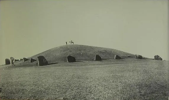
A royal kurgan in Khakassia ringed by upright slabs of Devonian sandstone weighing up to fifty tons — the stone was hauled seventy kilometres. Before excavation the mound stood twenty-five metres high. Inside was a burial with several attendants, killed, to all appearances, for the purpose. The valley around it is called the Valley of the Kings: there are several dozen kurgans here and most are untouched.
Comments
No comments yet. Be the first.